Town of Yarmouth Accessibility Map
Consultation has concluded
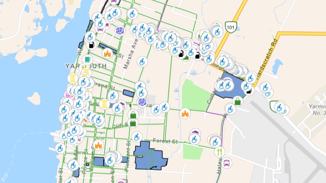
The Town of Yarmouth has been very fortunate in recent weeks to have hosted two student Co-op placements from YCMHS. Charlie McLaughlin and Ryan Montambeault are students of the Technology Advantage Program, which is a pilot program focused on giving youth exposure to technology before enrolling in post secondary education. The two talented students have been placed with the town's Planning Department, and have very excitedly been working on an online Accessibility Map for the Town of Yarmouth. The map is awesome, and is close to being ready to launch. But they need public input.
Here's more directly from Charlie and Ryan:
"We are currently in development of a map for all the accessible locations in the Town of Yarmouth. This has been a 3-4 month project using ArcGIS software to properly display all accessible points of interest in the town.
We are excited to have it launched, but need your feedback first. We are asking everyone to please offer feedback by May 9th. Please check out the map below and offer your thoughts using the "Ideas", "Show Us on a Map" and "Questions" tools at the bottom of the map. Your input is greatly appreciated!"
Map Use Instructions:
By default, the map shows all points of interest at the same time. Using the zoom tools in the upper left corner, zoom in closer to an area you wish to explore. You can then mouse over and click on a point of interest icon. A pop-up window will provide more details about the location.
Search by Category
Below the map is an interactive legend. The legend breaks down the points of interest by category, making it easier to find a specific type of location. Select a category you wish to explore such as "Entertainment" or "Museums", and the map will update showing points of interest from those categories only. Once you see a location of interest, mouse over it and click for more details.
Do you have questions about this accessibility map? We would be happy to answer them. Send them now and we will get back to you as quickly as possible!